
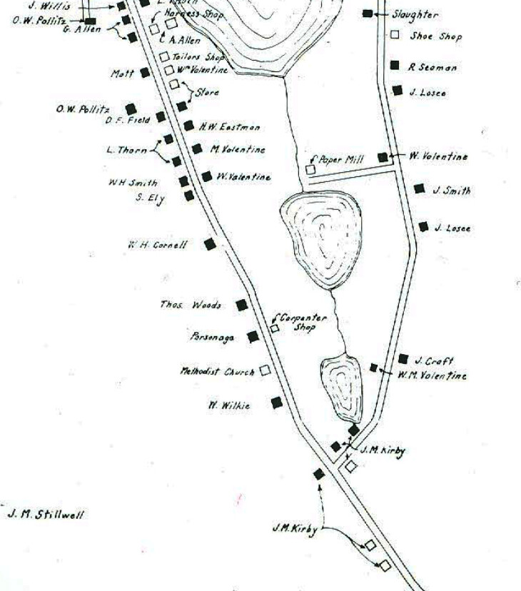
The 1859 Roslyn map by E.F. Walling was one of earliest documentation of the buildings in the village. As described on this map:
"(It) was enlarged from topographical map of the counties of Kings & Queens, NY, from surveys under the direction of H.F. Walling, N.Y., W.E. and A.A. Baker, 1859, 62"x60#, Eng. by H.F. Walling. From map on exhibit at William M. Valentine House, Roslyn, New York."
The 1859 map is accompanied by the below pdf key to 32 properties on Main Street, Roslyn that was created by the Roslyn Landmark Society around 1975.


Tags
0 Comments