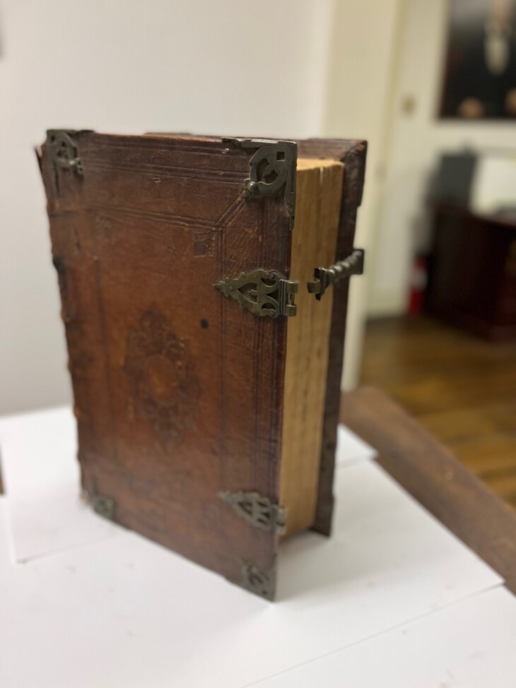
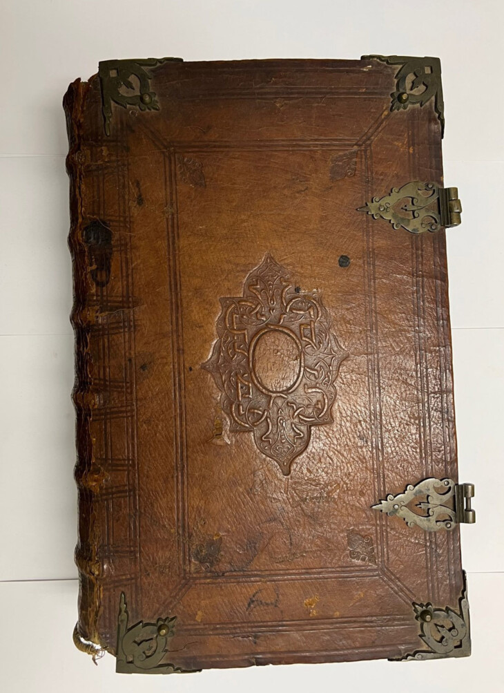
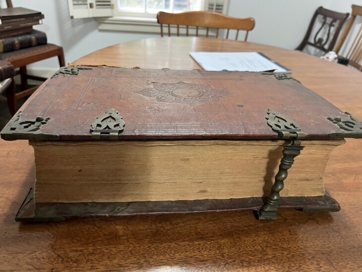
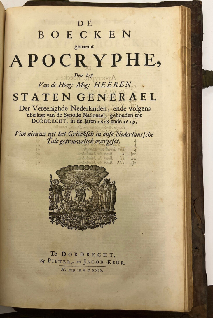
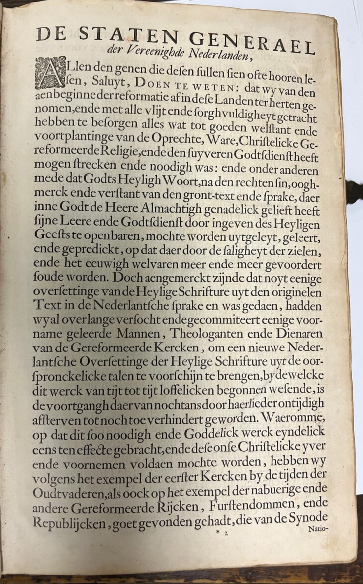
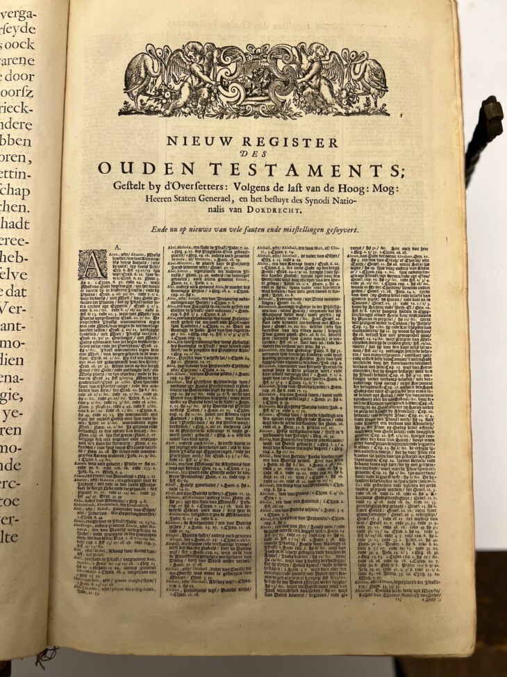
Among the treasures from the Roslyn Landmark Society archives is a 1729 Keur edition of the “Staten Bijbel”, the States General Bible. This bible was the official protestant translation of the Bible into Dutchthat was established in 1618-1619 at the Synode of Dortrecht. The 14 inches by 9 ½ inches bible includes six maps and 51 vignette illustrations. The book was printed by Pieter and Jacob Keur, who were known for their fine printing and accuracy of the text.
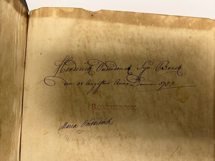
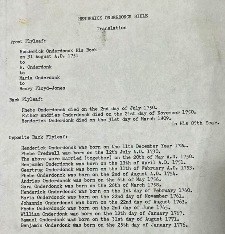
As inscribed in its front flyleaf, this bible was originally owned by Roslyn resident Henderick Onderdonck (Hendrick Onderdonk) on August 31, 1751. Onderdonck (1724-1809) was the owner of the Roslyn Grist Mill from 1758 to 1809 and the Roslyn Papermill, the firs paper mill in New York State. On April 24, 1790, Hendrick Onderdonck was visited by President George Washington in his Roslyn residence adjoining the grist mill. Washington referred to the grist mill in his diary. It remained in the Onderdonk family passing to Benjamen Onderdonk to Maria Onderdonk and then to Henry Floyd-Jones.
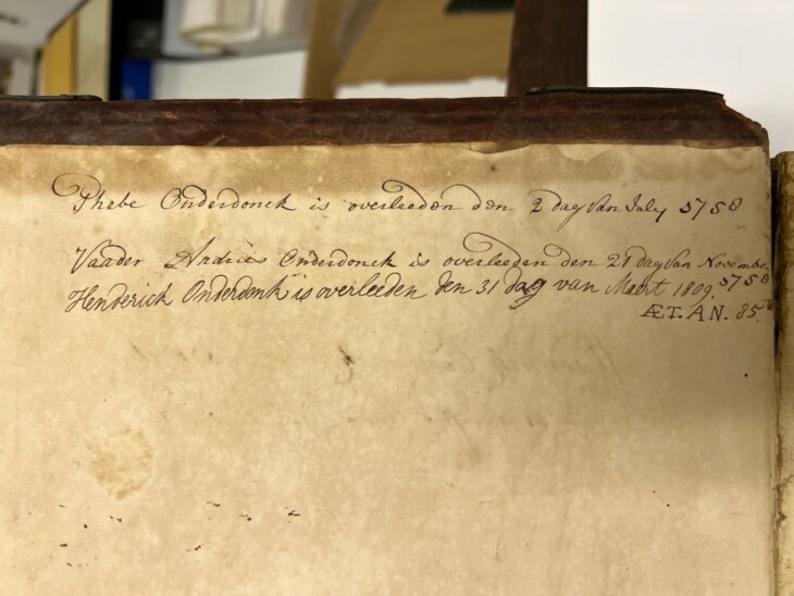
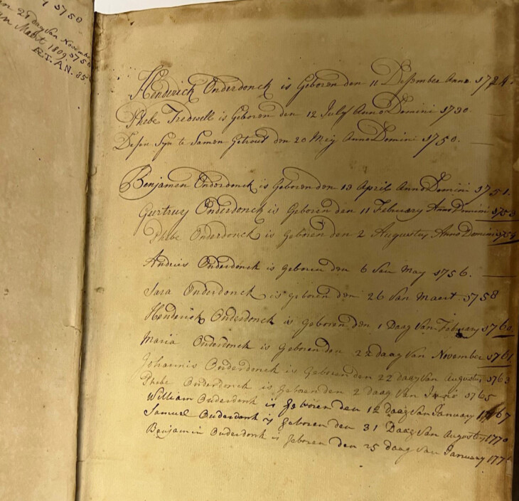
Hand-written in Dutch, the bible documented the wedding date of Henderick Onderdonck to Phebe Tredwell on May 20, 1750 on the birthdays of 14 members of the Onderdonck family.
The bible will eventually be exhibited in future Roslyn Landmark Society educational center at the restored Roslyn Grist Mill.
Hand-Written Inscriptions
According to the New Netherland Institute, "the blank pages in the front and back of old family Bibles or the pages in between the Old and New Testaments contain records not only of births, deaths, etc. but also records of unusual events such as earthquakes and heavy snow falls."
The following inscriptions were found in the Onderdonck Bible:
Initial Pages

Maps
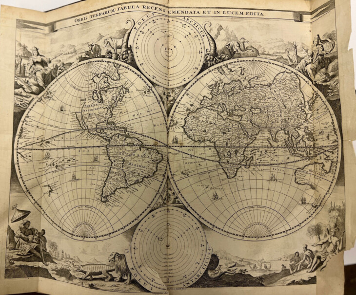
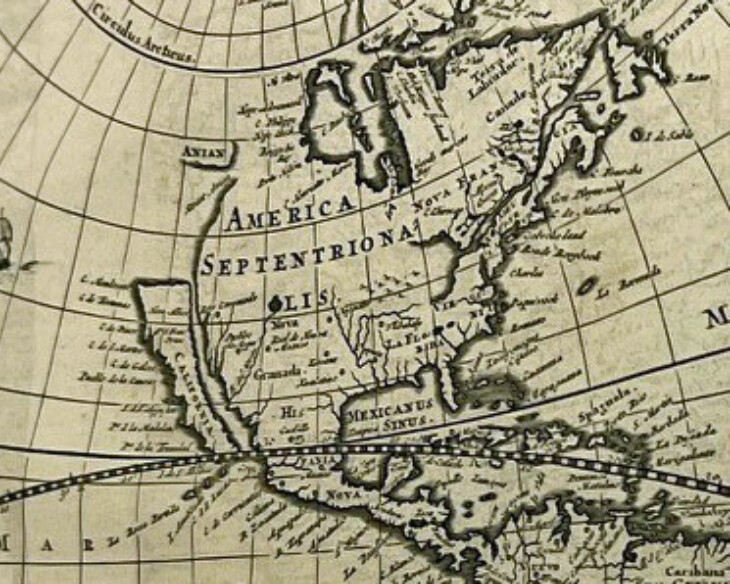
Map of America showing California seen as an island. Adapted from the Visscher world map of 1658.
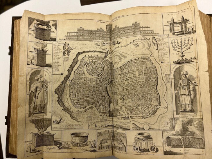
A plan for Jerusalem.
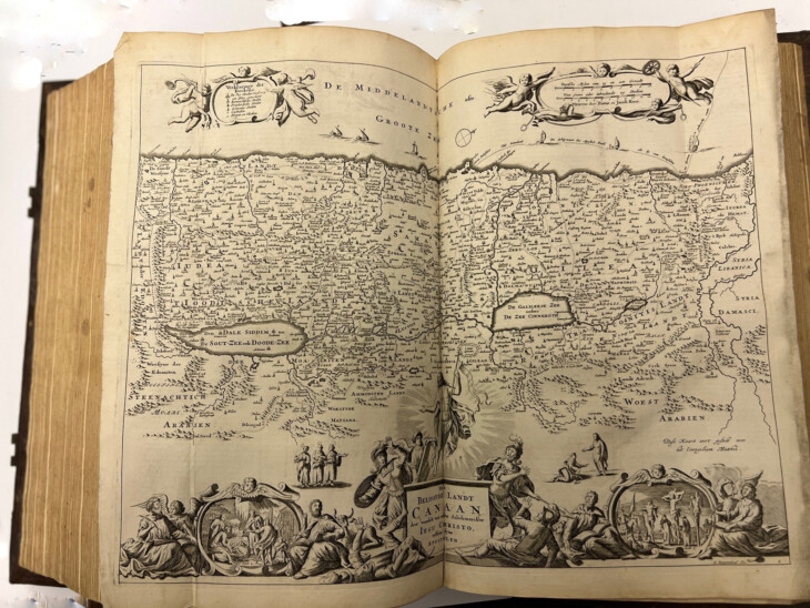
Map of Canaan- current location of Israel, West Bank and Jordan
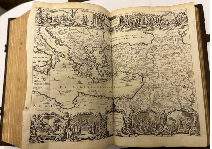
St. Paul's journey around the Mediterranean.
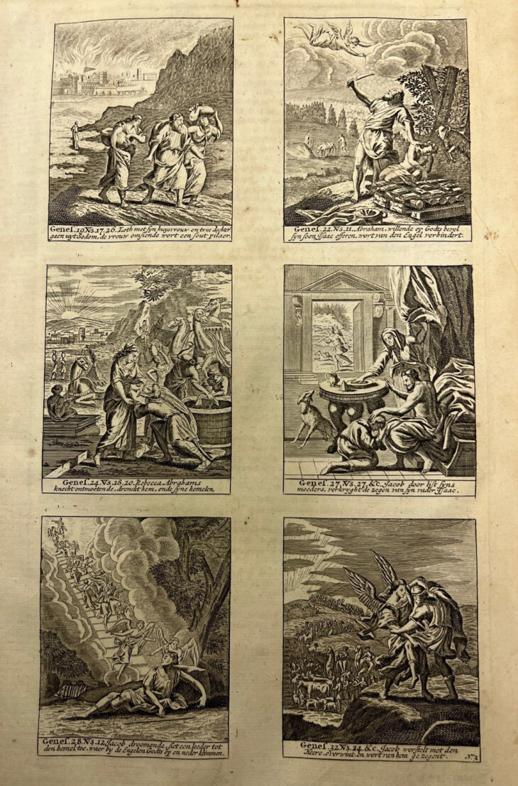
Vignettes

1 Comments
A wonderful find, indeed and its rich contents have been well displayed. I was particularly struck by the US map, with the middle of the country mostly blank and California floating in the ocean. The Dutch Counsel should help us with it.